Prompt
{
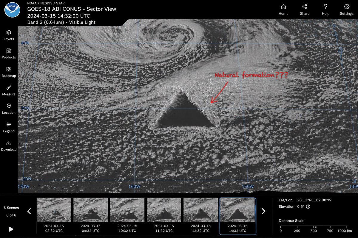
  "type": "satellite imagery web interface mockup",
  "main_display": {
    "imagery": "greyscale satellite view of ocean clouds featuring a {argument name=\"anomaly shape\" default=\"massive, perfectly geometric dark triangle\"} in the center",
    "annotation": "red handwritten text '{argument name=\"annotation text\" default=\"Natural formation???\"}' with a red arrow pointing to the anomaly",
    "overlay": "faint blue latitude and longitude grid lines with coordinate labels like 40N, 30N, 160W"
  },
  "ui_layout": {
    "top_header": {
      "left_section": "NOAA logo, text '{argument name=\"satellite name\" default=\"GOES-18 ABI CONUS - Sector View\"}', '{argument name=\"timestamp\" default=\"2024-03-15 14:32:20 UTC\"}', and 'Band 2 (0.64µm) - Visible Light'",
      "right_section": "4 navigation icons with labels: Home, Share, Help, Settings"
    },
    "left_sidebar": {
      "count": 7,
      "items": ["Layers", "Products", "Basemap", "Measure", "Location", "Legend", "Download"]
    },
    "bottom_panel": {
      "timeline": {
        "controls": "Play button, left/right arrows, text '6 Scenes', '6 of 6'",
        "thumbnails": {
          "count": 6,
          "description": "sequential satellite images showing the anomaly's progression, with hourly timestamps from 08:32 UTC to 14:32 UTC"
        }
      },
      "data_readout": {
        "coordinates": "{argument name=\"coordinate text\" default=\"Lat/Lon: 28.12°N, 162.08°W\"}",
        "elevation": "Elevation: 0.5°",
        "scale": "Distance Scale bar from 0 to 1000 km"
      }
    }
  }
}
Aufforderungen
Satellite Anomaly Interface Mockup
Generates a realistic web interface for satellite imagery featuring a mysterious geometric anomaly, timeline thumbnails, and UI controls.
Profile / Avatargpt-image-2
Modell
Modell
gpt-image-2
Sprache
en
Autor
Erstellen Sie mit dieser Eingabeaufforderung
Verwenden Sie den Generator unten, um diese Eingabeaufforderung mit dem verfügbaren Modell und den verfügbaren Einstellungen neu zu mischen.
Nach dem Absenden werden hier neue Aufgaben angezeigt.